
 In the first part of our series on drone sensors, heliguy™ walked through the basics and began to discuss how unmanned aircraft are impacting on a variety of commercial sectors. Now it’s time to delve into some of these industries and find out why drones are becoming such an integral part of business operations.
Part 2: The Commercial Future of Sensors
The second entry in the series puts this question to companies and individuals involved with bringing drones into the mainstream and getting their thoughts on what the future holds. In preparing this entry, heliguy™ has been in touch with professionals across a range of sectors. We’d like to thank them for their cooperation and the insights they have provided into how drones are affecting their industries. Below, we run down the top five most promising industrial arenas for drone use, gain insight from the pros and present their opinions on the commercial future of both drones and their sensor technology.1. Agriculture
 One of the most promising sectors for drones is currently agriculture. As well as providing innovative services such as precise aerial crop monitoring and water level inspections to ensure the effectiveness of irrigation solutions, there’s also the fact that using drones greatly reduces costs currently incurred by using manned aircraft to perform these tasks.
With multispectral and thermal solutions, as well as standard visual imaging sensors, it’s possible to build up a huge well of data to draw from while covering vast areas of land that would range from impractical to impossible to traverse by standard means.
For an insider view on drones are directly benefitting this industry, heliguy™ spoke to the team at Cereals, a renowned agriculture festival to ask why they’ve decided to include a ‘Drone Zone’ in this month’s upcoming event.
One of the most promising sectors for drones is currently agriculture. As well as providing innovative services such as precise aerial crop monitoring and water level inspections to ensure the effectiveness of irrigation solutions, there’s also the fact that using drones greatly reduces costs currently incurred by using manned aircraft to perform these tasks.
With multispectral and thermal solutions, as well as standard visual imaging sensors, it’s possible to build up a huge well of data to draw from while covering vast areas of land that would range from impractical to impossible to traverse by standard means.
For an insider view on drones are directly benefitting this industry, heliguy™ spoke to the team at Cereals, a renowned agriculture festival to ask why they’ve decided to include a ‘Drone Zone’ in this month’s upcoming event.
Cereals: The Aerial Future of Agriculture
The Cereals Event is the leading technical event for the UK arable industry with over 64 hectares of stands and live demonstrations. It brings together over 25,000 professional farmers and industry experts over two days. Here’s what they had to say to heliguy™ about the increasing prevalence of drones in an agricultural setting:...
The opportunities for drones in agriculture are numerous, and the way technology has been embraced by producers globally is inspiring to see. With population, water and food security challenges upon us, farmers have the need to see increased efficiency both in product usage, time and fuel. Drones provide part of the solution to many of these issues and farmers both in the UK and beyond are starting to use them in their daily lives. In terms of what drones can deliver, we view them very much as a vehicle for different types of data capture, and in the future, maintenance on farms. Currently, we are seeing a variety of cameras being used, these can identify weeds and patches of crops that need extra nutrition, pest control and the farmer to see his entire farm in a quarter of the time it would take to go around on foot. This delivers not only a time saving, but also reduces the need for crop protection products or fertiliser to be used. This is known as Precision Agriculture. Agricultural technology is moving quickly and it may not be long before drones have moved beyond data capture, and into weed removal through lasers and targeted crop protection application, further reducing the need for large farm vehicles to cover whole fields and supporting a reduction in soil erosion. Jon Day, Event Director of Cereals, had the following to say on the inclusion of drones in the event: “Drones featuring at Cereals is the obvious next step for us in supporting farmers to be more profitable. The ‘Drone Zone’ will allow farmers to try out unmanned aircraft, see the data they are able to capture and how this can benefit their business. Drones could be integral on the farms of 2020 and Cereals is delighted to be the first UK event to showcase them in such detail.”...
For more details about the event, visit their website. It’s certainly compelling to see how enthusiastic those within the agricultural sector are becoming about drone solutions. It’s no real surprise that many are touting it to become the highest growth industry for the commercial use of drones, especially with the increasingly data-driven focus on farming and crop management.2. Filmmaking & Photography
 Creative, visual industries require the freedom and tools to capture peoples’ imagination with stunning imagery. This need is being met with the addition of drones to filmmakers’ and photographers’ equipment.
Adding an unmanned craft complete with a stabilised gimbal to their set-up allows professionals to take stunning panoramic shots, capture breath-taking aerial footage and gain exciting new perspectives on their subject.
Creative, visual industries require the freedom and tools to capture peoples’ imagination with stunning imagery. This need is being met with the addition of drones to filmmakers’ and photographers’ equipment.
Adding an unmanned craft complete with a stabilised gimbal to their set-up allows professionals to take stunning panoramic shots, capture breath-taking aerial footage and gain exciting new perspectives on their subject.
Philip Bloom: Drones Advancing Filmmaking
We asked filmmaker Philip Bloom for his thoughts on how the new perspectives offered by drones have changed the way we see the action onscreen and what progress he thinks the next decade will bring: "Drones are the single most exciting advance in filmmaking of the past ten years. They aren't just about being helicopter replacements for aerial shots, they let you put a camera in places you could never reach any other way. They give you the ability to perform ‘impossible moves’ like an endless dolly shot or a tracking shot that becomes a ridiculously high jib shot. The possibilities are virtually endless.” “This is a such a new thing for the filmmaking industry that laws and regulations are playing catch up. Globally it is all over the place from no regulations in one country to outright no flying at all in some. Hopefully, in ten years this will all be figured out (well before ten years ideally) but the advances in technology is hard to gauge so far in the future. So much has happened in two years. In ten? Will we have silent, bladeless drones? Probably. Don't ask me how! I don't make them, I just use them and using them is the most fun you can have filming without question!" There’s a huge range of visual sensors available to those pursuing a commercial venture in aerial photography or filmmaking. Ranging in size from the huge RED EPIC (able to be taken airborne by a DJI Matrice 600 with a Ronin-MX gimbal) to the Blackmagic Pocket Cinema Camera and smaller still with GoPro models, whatever you’re looking to capture, there’s a drone / camera combination to do it.3. Emergency Services
 At heliguy™, we spend a lot of time talking to a variety of emergency service departments. Our bespoke training courses put us into contact with police forces and fire brigades from all over the UK.
The largest trend we’ve noticed is the move towards thermal sensors. They are used by the police for surveillance and the tracking of suspects and also by fire services surveying active blazes. The variety offered by thermal cameras such as DJI’s Zenmuse XT alongside drones like the Inspire 1 (a firm favourite of the UK’s emergency services), officers on the front line get a responsive aerial overview with a level of usable data previously not possible.
Unmanned aircraft are also beginning to find their footing in search and rescue operations, able to cover a vast area much quicker than a team on foot and with less red tape than bringing in a helicopter.
At heliguy™, we spend a lot of time talking to a variety of emergency service departments. Our bespoke training courses put us into contact with police forces and fire brigades from all over the UK.
The largest trend we’ve noticed is the move towards thermal sensors. They are used by the police for surveillance and the tracking of suspects and also by fire services surveying active blazes. The variety offered by thermal cameras such as DJI’s Zenmuse XT alongside drones like the Inspire 1 (a firm favourite of the UK’s emergency services), officers on the front line get a responsive aerial overview with a level of usable data previously not possible.
Unmanned aircraft are also beginning to find their footing in search and rescue operations, able to cover a vast area much quicker than a team on foot and with less red tape than bringing in a helicopter.
LMRT: Furthering the Reach of Search & Rescue
While there are still issues concerning performance in extreme weather conditions, industry professionals such as Rob Johnson, drone filmmaker at filmuphigh.com and Chair of the Llanberis Mountain Rescue Team, told heliguy™ that there’s huge potential: “ we are able to map an area of 120 acres in about 15 minutes. This would be ideal for lowland type searching or for smaller mountain areas where a specific location has been identified.” “For example, where a trailing dog has given a direction of travel the drone could be used to search a specific area. In water rescues, the drone could be used to establish the presence of people in flooded areas using a traditional camera.” He went on to explain: “Drones could also be used to map an area at high resolution (2 inch/pixel) which would allow extremely detailed analysis of an area retrospectively back at base. This map is Geo-Referenced and could be used as part of the search management.” “Software exists to allow this type of mapping to be automated i.e. the software takes control of the flight of the drone to ensure the whole area is mapped at the most efficient speed, resolution and image overlap. It would be interesting to see how this translated into a search environment.” This level of scope and detail allows for much more effective, coordinated efforts which could greatly raise the chances of finding people in serious danger. Johnson also specifically noted that the DJI Matrice 600 will be an extremely valuable asset upon its imminent release. As for the future of drones in search and rescue efforts, he continued: “The future use of drones could be very exciting for UK search and rescue. DJI recently announced a drone that can carry 10kg and is fully weather sealed. It has been built for crop spraying but alternate possibilities include deployment of kit, confirmation of casualty position and audio advice.” “The next step will be to get hold of the kit and undertake some trials. If they prove successful I can envisage the system being useful to many of the 48 teams that comprise Mountain Rescue England & Wales. However, there are still sceptics in the organisation and we would need to prove drones are useful to all concerned. Watch this space!” When lives are on the line, it’s necessary to have all the support you can get. It’s evident from the comments above that drones with advanced sensors are stepping up to this demand. There may still be some improvements to be made, but emergency services are already feeling the benefits.4. Surveying
 There are clear advantages to using unmanned aircraft to perform surveys on large structures and hard-to-reach facilities such as oil rig platforms. The quality of footage available from existing visual imaging sensors provides operators with enough data to either identify issues or sign off the survey.
These advances look set to affect the way surveys will be carried out in industries as disparate as Real Estate, Oil Pipeline Management and Pest Control. Thermal technology also gives more options and control to surveyors, especially when performing checks on the output of power lines or renewable energy sources.
Getting a top down view of the subject is sometimes crucial so it’s no wonder that many companies have begun to move into the ‘aerial survey’ market (which requires training to receive CAA permissions if you’re looking to enter the UK market).
Heliguy spoke to Mitie, a strategic outsourcing and energy services company with over 25 years experience within a range of industries why they’ve turned to drones to survey high-rise structures:
"Mitie will be using drones as part of our pest control offering. They will be used to carry out surveys to inspect roof areas before sending technicians to clear bird nests and debris. The use of unmanned aircraft has massive health and safety benefits."
Using drones to carry out pest control surveys in and around large structures seems like a no-brainer; especially, as Mitie themselves noted, that it reduces the risk to employees in the field. They went on to explain:
"The main advantages of using drones are that they save time and make the job safer. By using this technology, Mitie is leading the way in the pest control market and we're also starting to use drones to take high-quality images for survey bids."
Allowing for crisp aerial shots to give bid tenders an advantage, it's clear that now is the time to take advantage of the visual sensors on offer; whether for pest control reconnaissance, structural surveys or even offshore work.
On the subject of offshore, access to drone-powered aerial surveys looks set to have a huge impact on how oil rig maintenance takes place. Until very recently the main methods by which rigs were monitored to detect, among other issues damage or leaks proved relatively ineffective and costly. In such a high stakes industry, a lack of accurate data can lead to time-consuming repairs or even forced downtime until the necessary actions have been taken.
On the subject of timeframes, London-based drone inspection company and heliguy™ client Sky Futures spoke to Bloomberg Technology on the topic saying:
"What we can capture in five days using a drone could take eight weeks with human inspectors.”
As this is mostly down to the high-quality visual data drones can capture, it’s no surprise that Sky Futures say of their approach to commercial activity:
"We view ourselves as a data business and not a drone business."
With more and more companies seeing the benefits of employing drones as surveying tools, it’s clear that they are already considered an asset. As unmanned craft and their array of imaging, analysing and thermal sensors continue to advance, you can expect to see them become commonplace in both structural and offshore surveys.
There are clear advantages to using unmanned aircraft to perform surveys on large structures and hard-to-reach facilities such as oil rig platforms. The quality of footage available from existing visual imaging sensors provides operators with enough data to either identify issues or sign off the survey.
These advances look set to affect the way surveys will be carried out in industries as disparate as Real Estate, Oil Pipeline Management and Pest Control. Thermal technology also gives more options and control to surveyors, especially when performing checks on the output of power lines or renewable energy sources.
Getting a top down view of the subject is sometimes crucial so it’s no wonder that many companies have begun to move into the ‘aerial survey’ market (which requires training to receive CAA permissions if you’re looking to enter the UK market).
Heliguy spoke to Mitie, a strategic outsourcing and energy services company with over 25 years experience within a range of industries why they’ve turned to drones to survey high-rise structures:
"Mitie will be using drones as part of our pest control offering. They will be used to carry out surveys to inspect roof areas before sending technicians to clear bird nests and debris. The use of unmanned aircraft has massive health and safety benefits."
Using drones to carry out pest control surveys in and around large structures seems like a no-brainer; especially, as Mitie themselves noted, that it reduces the risk to employees in the field. They went on to explain:
"The main advantages of using drones are that they save time and make the job safer. By using this technology, Mitie is leading the way in the pest control market and we're also starting to use drones to take high-quality images for survey bids."
Allowing for crisp aerial shots to give bid tenders an advantage, it's clear that now is the time to take advantage of the visual sensors on offer; whether for pest control reconnaissance, structural surveys or even offshore work.
On the subject of offshore, access to drone-powered aerial surveys looks set to have a huge impact on how oil rig maintenance takes place. Until very recently the main methods by which rigs were monitored to detect, among other issues damage or leaks proved relatively ineffective and costly. In such a high stakes industry, a lack of accurate data can lead to time-consuming repairs or even forced downtime until the necessary actions have been taken.
On the subject of timeframes, London-based drone inspection company and heliguy™ client Sky Futures spoke to Bloomberg Technology on the topic saying:
"What we can capture in five days using a drone could take eight weeks with human inspectors.”
As this is mostly down to the high-quality visual data drones can capture, it’s no surprise that Sky Futures say of their approach to commercial activity:
"We view ourselves as a data business and not a drone business."
With more and more companies seeing the benefits of employing drones as surveying tools, it’s clear that they are already considered an asset. As unmanned craft and their array of imaging, analysing and thermal sensors continue to advance, you can expect to see them become commonplace in both structural and offshore surveys.
5. Delivery
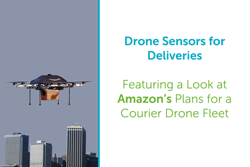 One of the commercial drone uses capturing the most public attention is their use for deliveries. The loudest proponent of the future of aerial courier services is undoubtedly online retail giant Amazon.
In 2015, Amazon’s CEO Jeff Bezos claimed that:
“One day, Prime Air deliveries will be as common as seeing a mail truck. The technical problems are very straightforward. The biggest issue, or the biggest thing that needs to be worked on, is the regulatory side.”
Recent reports on Amazon's plans also note that they are intending to take a modular approach to the construction of their drones, with the craft being built pre-delivery based on the weather and environmental factors.
Even without this on-the-fly approach, there are still questions about the logistics and safety of drone delivery fleets passing over highly populated areas. But while there may be more research and work to do, the concept is definitely not out of the question.
This is where sensors come in.
With obstacle avoidance becoming ever-more advanced, these concerns over safety may soon become a thing of the past. Consumer drones like DJI’s Phantom 4 already contain this technology and it seems set to roll out across their future releases.
Despite numerous hurdles, Amazon has continued to be bullish over their desire to use drones. In March, it was revealed that they had filed a sensor patent which would enable drones to tell people in their landing zone to “Watch Out!” and also display LED messages.
It’s not just Amazon that’s eyeing up the potential of drones, plenty of other schemes have seen deliveries take place such as the medical supply drops set to start in Rwanda this month courtesy of Silicon Valley tech firm Zipline and China’s test runs of grocery deliveries in rural areas.
While there have been intriguing trials from the likes of DHL, UPS and more recently a different approach from Wal-Mart who are looking to unmanned aircraft to fulfil warehouse stocking duties; it may still be some time before we’re receiving our shopping via drone. But, as sensor technology continues to develop, it may not be as far away as some think.
One of the commercial drone uses capturing the most public attention is their use for deliveries. The loudest proponent of the future of aerial courier services is undoubtedly online retail giant Amazon.
In 2015, Amazon’s CEO Jeff Bezos claimed that:
“One day, Prime Air deliveries will be as common as seeing a mail truck. The technical problems are very straightforward. The biggest issue, or the biggest thing that needs to be worked on, is the regulatory side.”
Recent reports on Amazon's plans also note that they are intending to take a modular approach to the construction of their drones, with the craft being built pre-delivery based on the weather and environmental factors.
Even without this on-the-fly approach, there are still questions about the logistics and safety of drone delivery fleets passing over highly populated areas. But while there may be more research and work to do, the concept is definitely not out of the question.
This is where sensors come in.
With obstacle avoidance becoming ever-more advanced, these concerns over safety may soon become a thing of the past. Consumer drones like DJI’s Phantom 4 already contain this technology and it seems set to roll out across their future releases.
Despite numerous hurdles, Amazon has continued to be bullish over their desire to use drones. In March, it was revealed that they had filed a sensor patent which would enable drones to tell people in their landing zone to “Watch Out!” and also display LED messages.
It’s not just Amazon that’s eyeing up the potential of drones, plenty of other schemes have seen deliveries take place such as the medical supply drops set to start in Rwanda this month courtesy of Silicon Valley tech firm Zipline and China’s test runs of grocery deliveries in rural areas.
While there have been intriguing trials from the likes of DHL, UPS and more recently a different approach from Wal-Mart who are looking to unmanned aircraft to fulfil warehouse stocking duties; it may still be some time before we’re receiving our shopping via drone. But, as sensor technology continues to develop, it may not be as far away as some think.
Learn More
If you haven’t already, don’t forget to read Part 1 of our series: Heliguy’s Guide to Drone Sensors Part 1: Introduction & Commonly Used SensorsGet in Touch
For more info about drone sensors in a commercial context, give us a call: UK: 0845 838 8652 Int: +44 (0)191 296 1024 Are you an expert on a specific commercial application of drones? Do you have insights into the marketplace you want to share? If you’re interested in having your opinions featured in our upcoming content, get in touch via info@heliguy.com.

Leave a comment